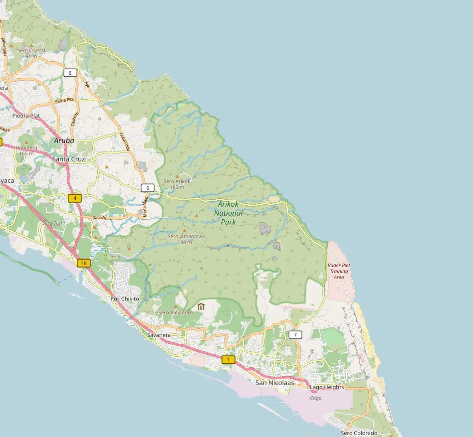
Fontein Cave sits in the north-eastern quarter of Arikok National Park, ten minutes of graded dirt from the San Fuego gate and a long, thirsty walk from anywhere else. Most people find it eventually. Plenty of them find the wrong ridge first, park in a gravel lay-by that belongs to nobody, and stand squinting at limestone wondering which gap in the rock holds the Arawak drawings.
What follows is the spatial half of the puzzle, a companion to our getting here guide. No ticket prices, no cultural deep-dive (the petroglyph page handles that properly). Just coordinates, gates, drive times, parking, signage and the offline kit that saves you when your phone dies somewhere past the park boundary.
Where Fontein Cave Actually Sits
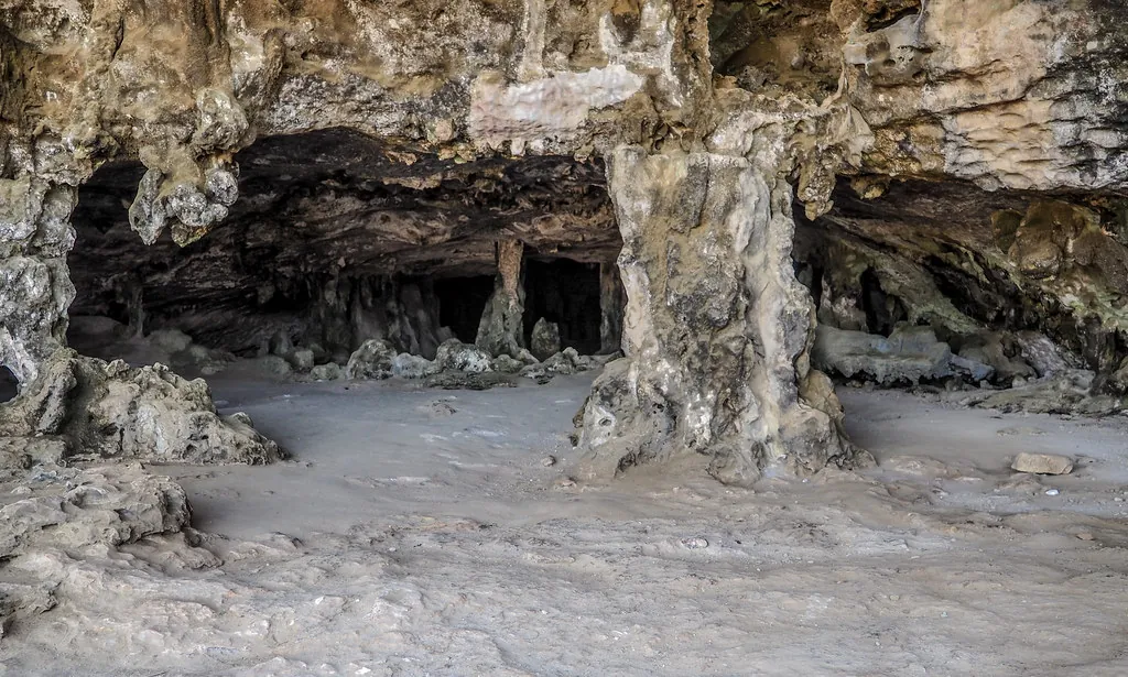
Parke Nacional Arikok covers roughly 34 square kilometres, about a fifth of Aruba’s land mass, and Fontein occupies its north-eastern coastal belt. The cave sits inland of the rocky shoreline, close to the old Fontein plantation, inside a limestone ridge that lifts out of the surrounding scrub. Fontein is Dutch for fountain or spring, and the name belongs to the water source that pulled people onto this slope long before anyone thought to charge admission.
The setting explains the drawings. Where there’s a spring in this landscape there’s shade, and where there’s shade there’s a reason for humans to stop, rest and leave a mark. Inside the dark chamber the air drops several degrees within a few steps of the doorway, and the limestone folds overhead like melted candles in an old cathedral, which is the comparison I keep coming back to after eight years of sketching the place.
On the park’s internal road network, the cave sits on a spur track branching north from the main San Fuego to coast route. From the visitor centre you’re about five kilometres away by road, which works out at fifteen to twenty minutes once you allow for the surface and the bends. Reach the Boca Prins dunes and you’ve overshot: turn around, because there’s no loop road that brings you back neatly.
GPS Coordinates and the Pin Problem
Fontein Cave sits at approximately 12.5033° N, 69.9175° W, or 12°30’12” N 69°55’03” W if you still read latitude the old way. Treat that as the ridge, not the doorway: it points at the cave complex and the parking apron beside it. Confirm the figure against the map handed out at the gate booth, since park tracks get regraded and commercial pins drift with every database update.
| Format | Value (approximate) | What it actually lands on |
|---|---|---|
| Decimal degrees | 12.5033, -69.9175 | Cave ridge and car park apron |
| Degrees, minutes, seconds | 12°30’12” N, 69°55’03” W | Same point, same apron |
| Google Maps search pin | Varies by device | Usually the car park, occasionally 300 m short of it |
| Rogue “Fontein” pin | Different grid square | Open scrub on the far side of the park |
Why your phone sends you to the wrong place
Two failures repeat themselves out here. The first is pin placement: search results drop you at the parking area, which is correct, except that it’s roughly 120 metres and one stooped doorway from what you came for. Drivers assume the pin has failed, see nothing cave-like, and continue along the track toward the coast. The second is a stray “Fontein” marker that circulates in older map data and lands on open ground nowhere near the plantation. If your route swings south into Santa Cruz and then heads west, kill the navigation and start again from the park map.
Tour vans work Fontein in shifts between about 10:30 and 13:00. Arrive before 09:30 and you may have the drawings to yourself; arrive after 14:30 and you’ll share the chamber with the geckos and whoever else ignored the midday heat. The hours in between are a bit of a faff: queuing at the doorway, waiting for someone’s tripod, sweat running down your back.
Which Gate You Drive Through
Arikok has two practical approaches for a Fontein run, and they are not interchangeable. Your choice changes the drive by twenty minutes and can change your insurance cover as well.
| Gate / Approach | Surface | Best for | Watch out for |
|---|---|---|---|
| San Fuego (main gate, Santa Cruz side) | Paved to the booth, then graded park road | First visits, saloon cars, anyone using the visitor centre | Booth queue in high season, gate closes to new entries late afternoon |
| Northern coastal track | Unpaved coral, rock and sand | 4×4 drivers, guided jeep convoys, confident locals | Hire-car policies that void cover off-road; no shade; no phone signal |
Drive times from the hotel zones
| Starting point | Distance to San Fuego gate | Realistic drive time | Leave by (for a 09:00 arrival) |
|---|---|---|---|
| Oranjestad town centre | About 20 km | 35 minutes | 07:40 |
| Cruise terminal, Oranjestad | About 20 km | 35 to 40 minutes | 07:35 |
| Reina Beatrix Airport | About 24 km | 40 minutes | 07:30 |
| Eagle Beach | About 22 km | 38 minutes | 07:35 |
| Palm Beach and Noord high-rises | About 27 km | 45 minutes | 07:25 |
| Savaneta | About 18 km | 32 minutes | 07:45 |
| San Nicolas | About 20 km | 35 minutes | 07:40 |
Then add fifteen to twenty minutes for the in-park transfer from the gate to the cave car park. Cruise passengers on a tight port window should read our tickets and tours page first, because a guided jeep safari removes the whole question of gates, surfaces and parking from your morning, and several of the standard island safaris call at Fontein as part of their loop.
Parking, and the Last Hundred Metres
The Fontein car park is small: space for perhaps twenty vehicles, plus a turning circle that tour vans and 4×4 jeeps use to swing around. Between 10:30 and 13:00 that circle becomes a negotiation. Independent drivers do best arriving before 09:30 or after 14:00, when the vans have moved on toward the Natural Pool and the light inside the cave is still workable. If the main area is full, pull onto the hardened shoulder of the approach track, leave the turning circle clear, and walk the extra fifty metres. Do not park on vegetation; the park staff notice, and rightly so.
From the car park to the cave mouth is roughly 120 metres. The surface is loose rock, sand and uneven limestone, with a short rise and a couple of steps worn smooth by decades of feet. The doorway is low, somewhere near 1.5 metres, so most adults stoop; once inside, the main chamber opens to three or four metres of headroom and you can stand upright while your eyes adjust. Somebody with knee or hip trouble will manage the walk with a stick and a slow pace, though there are no handrails and no shade on the return leg. At one in the afternoon that same 120 metres feels three times as long, and the heat radiating off the limestone is genuinely punishing. Carry water, wear closed shoes and take the walk back slowly.
Finding It Without Signal
Mobile coverage thins as soon as you leave the built-up strip, and inside the park’s interior it disappears for long stretches. Download before you leave the hotel wifi.
- Offline Google Maps tiles covering Santa Cruz, San Fuego and the whole Arikok boundary: the standard road layer is incomplete inside the park, so switch to satellite or terrain before saving.
- Organic Maps or Maps.me with the Aruba region downloaded, as a second opinion when Google’s pin placement looks wrong.
- A screenshot of the official park map from the Arikok National Park website, saved to your camera roll where it can’t fail to load.
- A paper map collected at the gate booth, which stays useful when a screen overheats in direct sun.
- Your hire car’s built-in satnav, treated with suspicion: the points of interest on rental units are often years stale and several still direct drivers to a closed route.
Reading the Signs
Park signage is brown, small and set low to the ground, which means you spot it late at 40 km/h on a rough surface. It helps at the big junctions and does nothing at the minor forks.
- Signs appear at decision points, not at every fork. Two or three unmarked splits exist between San Fuego and the cave; hold your line and keep heading north-east.
- Count your turn-offs rather than trusting each signpost: gate booth, first junction, second junction, then the Fontein spur on the left. Four decisions and you’re there.
- Distances are rarely printed. Judge progress by landmarks instead, such as the low white plantation walls and the first sight of the coastal rock.
- If you reach a sign for Boca Prins or the dunes, you’ve gone past the spur. Turn around; the cave track doubles back inland.
- Guided convoy vehicles move fast on the same tracks. Pull over, let them pass, and don’t follow them: they’re often heading for the Natural Pool, not the cave.
How Fontein Relates to Quadirikiri, the Cave Pool and the Visitor Centre
Quadirikiri Cave
Quadirikiri sits a few kilometres south-west of Fontein, closer to the main park road, and it is the larger and busier of the two. Two chambers, a light shaft that drops through the roof, and a staircase that makes access straightforward. Fontein wins on rock art; Quadirikiri wins on scale and on light for photography. Most self-drive visitors do both in a single loop, and our cave comparison guide explains which order works best.
The cave pool
Swimming in the park’s natural pool has been off the table since 2018, closed for safety and for the ecology of the basin. Outdated blog posts still send people there expecting a dip. Check the current position on our cave pool status page before you build a day around it, and treat any 2019-era guide as fiction.
The visitor centre
San Fuego’s visitor centre is your last reliable stop: toilets, water, an exhibition on the park’s geology, and staff who know which tracks were graded last month. Pay your entry fee here and pick up the printed map. From the centre to Fontein is about fifteen minutes by car, and it’s the sensible place to regroup if the pin problem has already bitten you once.
Nobody gets lost in Arikok. People get confident, and confidence is what puts them on the wrong ridge.
Getting Your Bearings: A Short Checklist
- Download offline maps and screenshot the park plan the night before, on hotel wifi.
- Drive to the San Fuego gate, pay the park entry fee and take a paper map from the booth.
- Set your navigation to the cave car park, not to the cave itself, and accept the short walk at the end.
- Count your junctions: booth, first fork, second fork, Fontein spur on the left.
- Park clear of the turning circle, facing out, so you can leave without a three-point shuffle.
- Walk the 120 metres with water, closed shoes and a light source, stooping at the doorway.
- On the way out, confirm your route back at the visitor centre rather than reversing your memory of the inward drive.
Sources and Where to Go Next
Coordinates, gate names and opening arrangements change more often than you’d think, so verify anything time-sensitive against the Arikok National Park official site, the Aruba Tourism Authority, or the Government of Aruba for island-wide road notices. Cruise passengers can check berth times through the Aruba Ports Authority before committing to a self-drive morning.
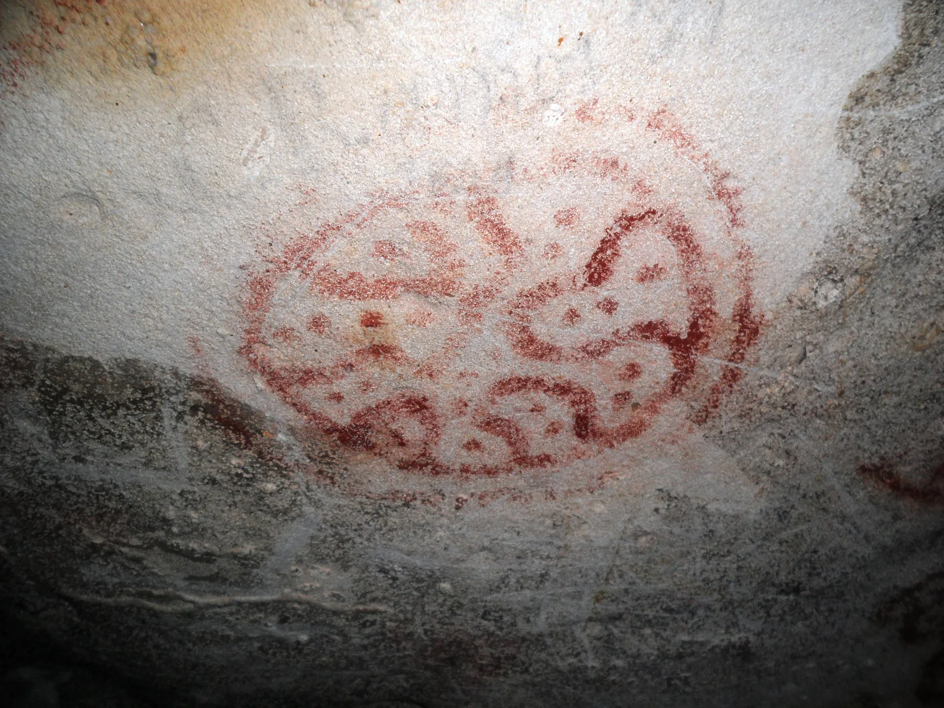
Once you’ve got the geography sorted, the rest of the site picks up where this page stops. The visitor rules page covers cave etiquette and the no-touch policy on the drawings; photos and formations explains how to shoot in low light without flash; Arikok and cave pool status sets the wider context; and the FAQ answers the quick questions about fees, timing and what to bring. If you’re weighing up a guided jeep safari against driving yourself, start with park fees and entry tips, which breaks down what a bundled tour actually includes.